



Frequently asked questions from travellers
Is the route signposted in both directions?
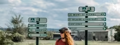
Yes, the Veloscenic route is signposted in both directions — whether you're riding from Paris to Mont-Saint-Michel or from Mont-Saint-Michel to Paris!
As of now, the entire route is signposted except within central Paris (intramuros).
Are there any guidebooks available for the Veloscenic route?
Currently, there are no English-language guidebooks available for the Veloscenic route. A guidebook was published by Excellent Books in 2018, but it is no longer being reprinted and the information is now partially outdated.
However, there are three French-language guidebooks available:
- The most recent editions, published by Glénat and Ouest-France, include detailed maps, navigation tips, cultural and historical highlights along the route, as well as Accueil Vélo-approved accommodations at each stage.
- A third guidebook was reprinted by Chamina in 2021, but it has not been reviewed by the Veloscenic route team.
Can I use my smartphone for navigation?
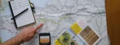
To follow the Veloscenic route on your smartphone, download a GPS app such as OsmAnd, Locus Map, Iphigénie, or Komoot, available on both Android and Apple devices.
Make sure to download the map layers within the app to enable offline use during your ride.
If you'd like to create your own custom GPS track, use our route planner to personalize your itinerary with start and end points on or off the Veloscenic route.
Is it easy to leave/enter Paris by bike?
Starting your adventure on the Veloscenic route in Paris is both exciting and much easier than you might think.
You begin on the forecourt of Notre-Dame Cathedral, the official “point zero” of all roads in France. Head towards Montparnasse via Rue de Rennes — the only tricky section being the crossing at Place du 18 Juin 1940.
Then follow the beautiful Promenade des Vallons de la Bièvre, known as the “green corridor of southern Paris,” which will calmly guide you to Massy along dedicated cycle paths.
Which route variant should I choose in Île-de-France?
Between Massy and Rambouillet, La Véloscénie divides into two routes. Both pass through the Haute Vallée Chevreuse Regional Natural Park and cover approximately the same distance (~60 kilometres). The differences lie mainly in the landscapes and heritage each route allows you to discover.
Versailles Route
66 km
47% on dedicated cycle paths
Fully signposted
Walking sections recommended on the Chemin de la Butte aux Buis (steep hill before Saint-Rémy-lès-Chevreuse)
What to discover
- The Toile de Jouy Museum
- Palace of Versailles
- Chevreuse town with its hilltop château
- Breteuil Château
- Rambouillet Estate
Limours Route
55 km
38% on dedicated cycle paths
Fully signposted
Rough surface section before and after the Fauvettes Viaduct (not recommended for road bikes and potentially muddy in wet weather)
What to discover
- The Fauvettes Viaduct
- The former Aérotrain test track
- Saint-Jean-de-Beauregard Château
- The medieval village of Rochefort-en-Yvelines
- Elsa Triolet – Louis Aragon House
Which route variant should I choose between Alençon and Bagnoles de l'Orne Normandie?
Between Alençon and Bagnoles de l'Orne Normandie, the Véloscénie splits into two variants. Both traverse the Normandie-Maine Regional Natural Park but offer very different experiences. The Pré-en-Pail-Saint-Samson route is the easier option, mostly on dedicated cycle paths with minimal elevation changes, whereas the Carrouges route features some notable climbs on quiet country roads. Choose based on your preferences: do you want to discover the Mont des Avaloirs, the highest peak in northwest France, or the elegant Carrouges Castle?
Pré-en-Pail-Saint-Samson Variant
Very Easy
No technical challenges
Almost entirely on dedicated cycle paths
Safe, well-maintained routes
Comprehensive signage
Easy to follow
Final 10 km with gentle descent into Bagnoles de l'Orne Normandie
Highlights
- Mont des Avaloirs (416m) – Highest peak in northwest France
- Notre-Dame de Lignou Chapel – Neo-Byzantine architecture with mosaics
- Couterne Castle Park
- Tomme de Pail – Local artisan cheese
- Mercerie Farm – Guided goat cheese tours and tasting
Carrouges Variant
Intermediate
Approximately 300m of climbing
Quiet country roads
Low traffic, authentic rural landscapes
Comprehensive signage
Easy to follow
Several short climbs before Carrouges – Not recommended for young children uncomfortable with elevation gain
Highlights
- Carrouges Castle – 14th–17th centuries, spectacular approach
- Normandie-Maine UNESCO Park Visitor Centre – Museum and local gift shop
- Roche-Mabile – Historic church and Cassine Chapel
- Lignières-Orgères Chapel – Flamboyant Gothic architecture
- Villiers Gorges – Picturesque and legendary natural site
How can I report an issue or problem?
You can submit a report in just a few clicks. This tool allows us to receive alerts in real time and display your report on the Veloscenic route website — helping future travelers and contributing to the improvement of the route.